WALDRINGFIELD HISTORY GROUP presents
THE WALDRINGFIELD HISTORY WALK
Presenter: Gareth Thomas Illustrator: Jackie Brinsley
➢ The walk starts at Waldringfield Village Hall where parking is free.
➢ The walk is just under 5 kilometres and is likely to take about 2½ hours.
➢ There are sections where the ‘going’ may be muddy.
➢ The walk is circular and returns the walker to the village hall car park.
➢ The ‘Maybush’ is situated about half-way round.
➢ There are twenty recommended stopping points as shown on the map
➢ Whilst there are no dangerous elements to this walk (apart from walking along public highways) we have to remind participants that they undertake the walk entirely at their own risk.
In 2020 the Waldringfield History Group (est.2007) published a book entitled “Waldringfield – A Suffolk Village beside the River Deben.” In that book, much of this walk was described as it might have been
i. in 1348, pre river walls
ii. in 1881, the height of the industrial revolution
iii. in June 1944 just prior to D-day and
iv. in 1971 at the start of what one might describe as the touristic revolution.
Most of what you read here may be found somewhere in those 300 pages. The River Deben and its environs change from day to day, hour to hour and, for many, there is an aura to it which makes one wonder what it must have been like in the past.
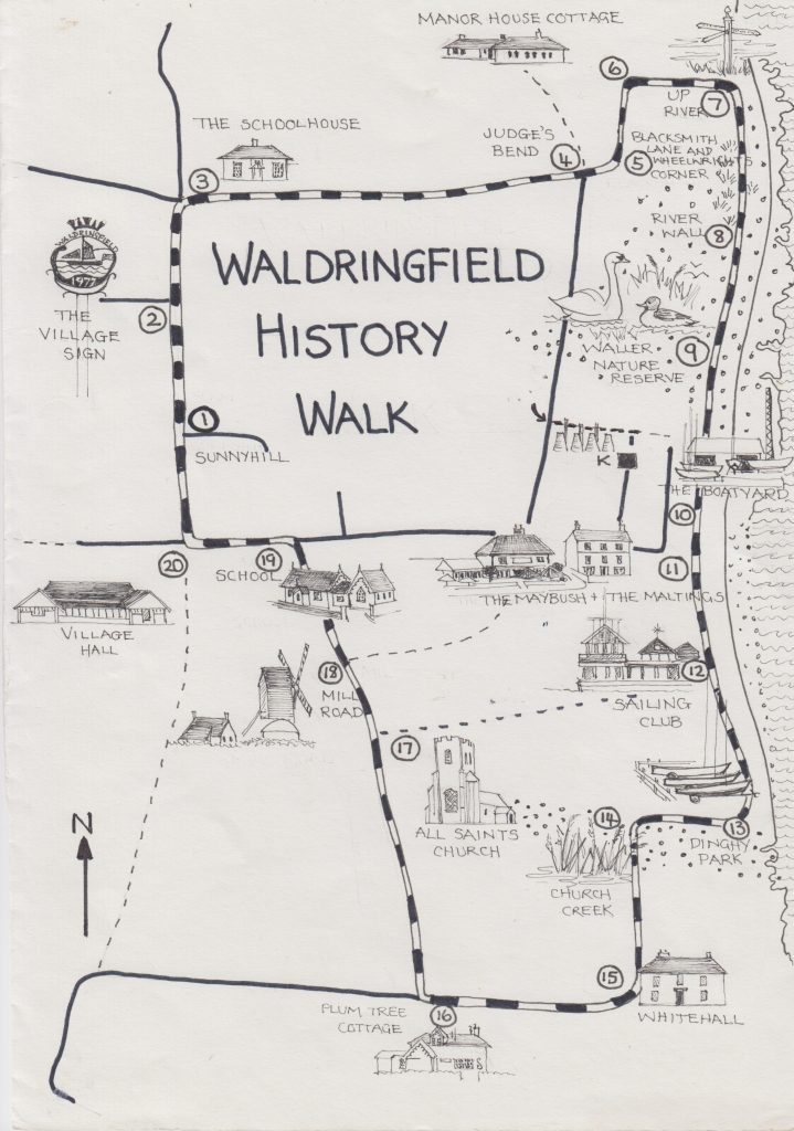
Jackie’s walk map by Jackie Brinsley
To download a copy of the walk either scan the QR code or click here

QR code for the Waldringfield Walk