


The official 2019 footpath map has a confusing Parish Boundary with a more southerly northern boundary and bulge at the Heath. Both maps courtesy of Suffolk County Council.

This is due to a legal technicality with the way footpaths are recorded on a 1954 map with a different boundary. So, the footpaths are correct but the boundary isn’t. We don’t know when it changed to the current one, possibly 1970s when the County reviews were undertaken. Here is the “definitive map” from SCC.

Deben first definitive map relevant date 1 January 1954
The definitive map parish boundary reflects the parish boundary as shown on the Deben first definitive map (relevant date 1 January 1954), see extract from the first definitive map below – the brown lines represent the parish boundary, which corresponds to the parish boundary as shown on the Ordnance Survey County Series 1:2500 scale map circa 1904/5.
This is the 2019 boundary from Ordnance Survey.

2019 Parish Boundary
In around 2019 the Parish Boundary was changed with a small land swap with Martlesham to make dealing with the new Brightwell Lakes development easier to deal with. The new boundary is shown below:
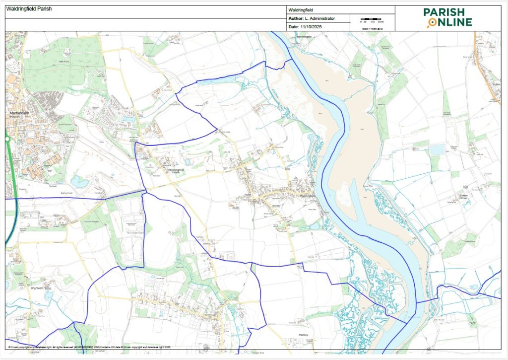
Waldringfield new Parish boundary 2019


Janet Elliott has spoken to SCC and this is the answer:
SCC is the body with the sole responsibility for producing and maintaining the Definitive Map which is then the conclusive legal record of PROW – see extract below. Makes sense as they are responsible for local “highways”.
“The Definitive Map and Statement form the legal record of public rights of way.
Under the Wildlife and Countryside Act 1981, Sections 53 and 57(5) the County Council
has a duty to keep the Definitive Map and Statement under continuous review and to make
them available for inspection by the public.
The Definitive Map provides conclusive legal evidence of the existence of the public rights
shown on it at the ‘relevant date’* of the Map (see below), but without prejudice to the
possible existence of unrecorded rights.”
SCC produce a definitive map for each parish. As we’ve seen the current one for Waldringfield is very recent as it’s dated October 2105 but the parish boundary is very out of date. I’ve now spoken to the person with responsibility for the Definitive Maps at SCC and he explained that the maps are regularly updated in terms of recording PROW but the parish boundary maps are those dating back to the 1950s. He explained that it would be a “massive job” to keep the parish boundaries up to date as they were constantly being “tweaked” by the relevant Parish/District/Borough Councils across the country – (is is the current situation with Martlesham’s application to change the boundary). But of a weak excuse really in today’s IT world but this is what they do.
So if we want to add or change a PROW this has to be done with SCC via its evidence and consultation process – WPC could make applications re paths outside the parish boundary shown on the definitive map.
However, SCDC/East Suffolk Council is the “keeper” and supplier of up to date information on the actual Parish Boundary.
see below from Local Government Boundaries Commission
“For parish boundary changes, the local district council can conduct a review and implement the recommendations, under the provisions of the Local Government and Public Involvement in Health Act 2007 We can conduct boundary reviews of district or county councils, either at the request of the Secretary of State, at the request of the relevant authority or if we identify boundary anomalies which in our view warrant a review”.
Margaret says she thinks it changed in 1974